The researchers of the Institute of Geography of our Faculty demonstarted and taught laser scanning and hyperspectral mapping with unpiloted aerial systems (UAS) during the International Remote Sensing Summer School in Sardinia.
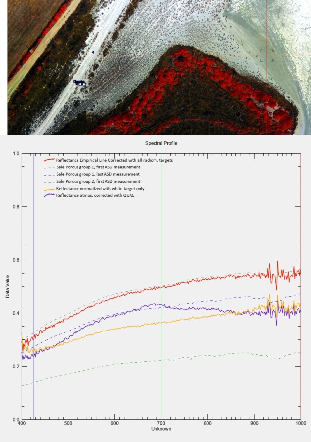
The European Space Agency (ESA) is developing new satellite missions capable of very sensitively distinguishing different types of materials on the Earth’s surface. This is made possible by the technology of image spectrometry (hyperspectral scanning), which is used to detect the quality of food, determine the chemical composition of substances, or the vitality of plants. For reliable calibration of space hyperspectral cameras, it is necessary to select surfaces which reflectivity does not change over a certain period and remains stable. Therefore, it is necessary to measure the reflectance on the ground and from low altitudes. Then it is possible to relate the reflectance values measured by the satellite with the absolute values in physical units measured on the ground and by airborne scanners. Analogously, the weight or volume of fuel at the gas station is calibrated. The occasionally drying salt lake Sal’e Porcus on the western tip of Sardinia near the towns of San Vero Milis and Riola Sardo appears to be a suitable calibration location for ESA.
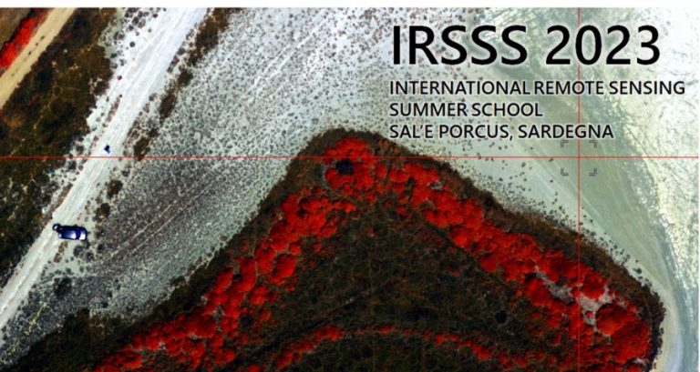
The lake became the main object of research between 15 – 20 July 2023 as part of the first year of the International Remote Sensing Summer School, the aim of which was the mutual sharing of knowledge and skills in the processing of hyperspectral and lidar data from ground, aerial and satellite measurements for the purposes calibration and validation of hyperspectral satellite data.
The event was organized by the Department of Chemical and Geological Sciences of the University of Cagliari and other intitutions also participated: Italian National Institute of Geophysics and Volcanology (INGV), the Italian Association for Remote Sensing of the Earth (AIT) and the Italian Space Agency (ASI).
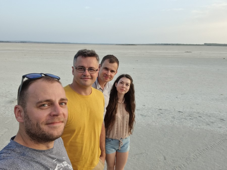
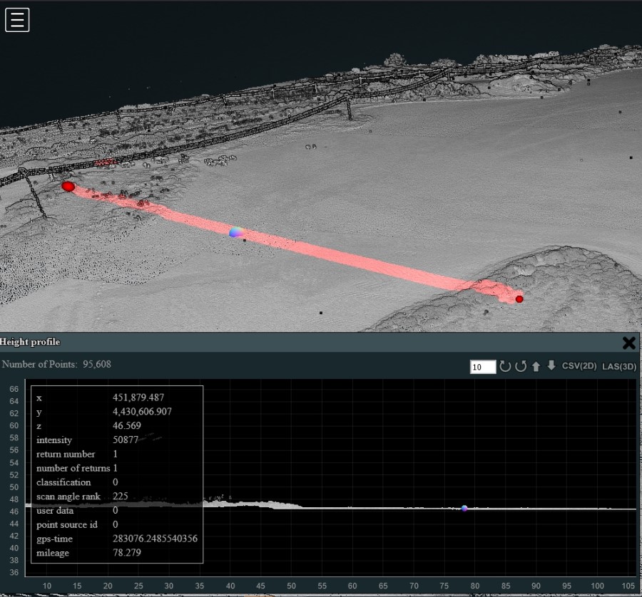
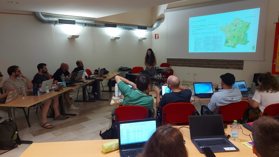
During the 5 roasting days, the lake Sal’e Porcus welcomed 25 doctoral students from all over the world, accompanied by a group of specialists from INGV, coordinated by Massimo Musacchio and Enrica Marotta, Tapete Deodato from the Italian Space Agency, Sergio Teggi from the University of Modena-Reggio Emilia, Saham Mirzael from the CNR , from the Department of Chemical and Geological Sciences of the University of Cagliari participated Maria Teresa Melis, Salvatore Noli, Francesco Dessì, Claudia Collu, Marco Casu, Mariana Carrea. Pavel Jozef Šafárik University in Košice was represented by 4 employees of the Institute of Geography, Faculty of Science: Dr. Ján Kaňuk, Dr. Michal Gallay, Dr. Ján Šašak, and Dr. Katarína Onacillová. They provided training and data collection with our UAS using a laser scanner VUX-1 by Riegl and a hyperspectral camera AISA Kestrel 10 by Specim.
Maria Antonietta Dessena from the Italian Association of Remote Sensing (AIT) and Xinlian Liang from the International Society for Photogrammetry and Remote Sensing (ISPRS) presented the activities of the associations and guaranteed the dissemination of the initiative at the international level.
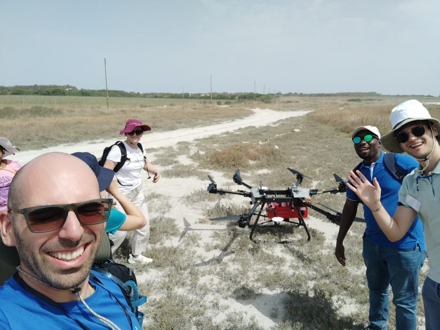
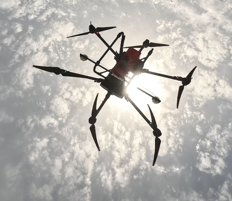
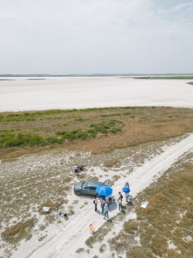
The school took off with a field work survey on the site using hand-held spectrometers to measure the true reflectance of the salt surface. The survey continued by mapping with UAS using lidar, hyperspectral and thermal scanners. The students directly experienced the installation of technology and the execution of an airborne mapping mission with unique measurement systems for the spectral, geological and topographical characterization of the dry salt lake bed. The air temperature during data collection exceeded 45°C. Only the early morning mapping with the ASI thermal unmanned system was a little more pleasant.
Over 300 GB of geospatial spectral data were acquired during the summer school. The first results of the implemented activities confirm the potential of the site in the spatial context and indicate the need to deepen the knowledge of the recent geological history.
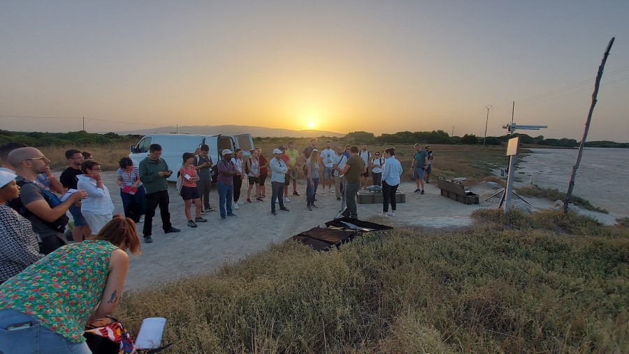
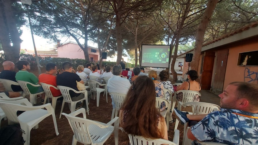
On Thursday, July 20, the summer school became part of the SHARPER (Waiting for the Researchers’ Night) public event, organized under the patronage of the municipality of San Vero Milis, entitled: “Sal ‘e Porcus: a sentinel of observations from space.” The public could learn about the importance of the lake for the European ecosystem as well as space observation of the Earth.
The direct tutoring of UPJŠ employees in Košice at the summer school is an example of the pan-European importance of the ERASMUS+ program, thanks to which the initial contact between the workplaces in Košice and Cagliari was established, which subsequently resulted in the joint implementation of the summer school using our technologies and know-how. Travel expenses for the summer school were covered by the ERASMUS+ program within the “teaching” mobility. The research tasks at the event were also related to the solution of scientific projects at the Institute of Geography:
ENEUM: Enhancing Earth Observation Curriculum with a Focus on ESA Sensors (4000140187/23/NL/SC/rp)
APVV-22-0024: Physical geomorphometry for physical geographic research
VEGA 1/0168/22: Paleogeographic and geodynamic interpretations of detrital minerals from selected areas of the Western Carpathians: a case study of the identification of the nature of transport conditions and source areas in karst and non-karst areas
Local media also reported on the event:
https://magazine.unica.it/scuola-estiva-per-studiare-i-dati-acquisiti-da-satellite/
https://www.geosmartmagazine.it/2023/05/01/international-remote-sensing-summer-school/
Short video about the impressions of the summer school participants:
Visualised data from laser scanning and hyperspectral scanning: