Laser scanning of the landscape makes it possible to capture the three-dimensional structure of the Earth’s surface and the objects on it with high accuracy and detail on the order of millimetres. In the form of a dense 3D point cloud, in addition to recording the geometry, it also provides other complementary attributes, among which the reflectivity of the material on the surface is particularly useful. Reflectance is the result of the interaction of this material and the incident electromagnetic radiation. Laser scanning uses its own infrared radiation and so can be used for scanning the surfaces of dark areas such as caves. The reflectance values of the wavelength of the laser used are related to the composition of the rocks in which the cave was formed.
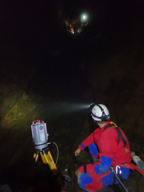
This is exactly the context that the team of researchers from the Institute of Geography of the Faculty of Science, Pavol Jozef Šafárik University in Košice, the University of Louisiana at Lafayette (USA) and the Université Côte d’Azur, Université de Rennes, Université de Toulouse (France) took advantage of in 2018 in the framework of an expedition to the Gouffre Georges cave in order to accurately map the geological features and manifestations of the tectonics in the northern slope of the French Pyrenees. The Gouffre Georges cave is unique in that it was formed along the contact of distinctly different rock types – Jurassic and Lower Cretaceous carbonate rocks and variably serpentinized lherzolite originating in the upper mantle, rarely observed at the Earth’s surface. The large size of the cave (300 x 40 x 40m) does not allow direct safe access by a geologist to the walls and ceiling to take rock samples, measure the inclinations of the layers, much less locate their exact position within the cave and relative to the Earth. Laser scanning has largely overcome these obstacles.
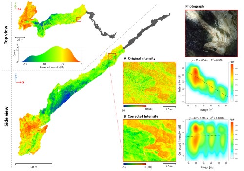
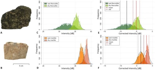
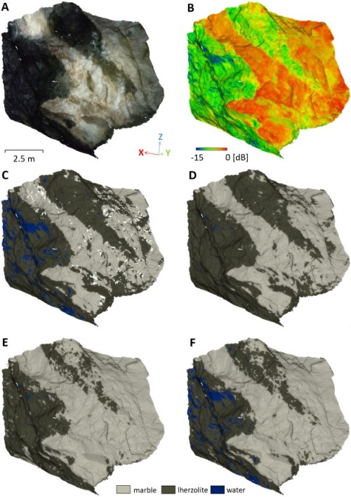
However, the use of reflected laser beam intensity for material differentiation and rock interpretation in the context of interbedding studies requires calibration and corrections for influencing factors that are different in the case of a cave than in an aboveground environment. For this reason, a research team led by doctoral student Michaela Nováková from the Institute of Geography of the Faculty of Science, Pavol Jozef Šafárik University in Košice proposed a procedure for correction of the reflection intensity from terrestrial laser scanning, which takes into account the influence of the scanner position relative to the cave surface and the micromorphology of cave surfaces. It was also possible to eliminate the effect of absorption of part of the laser beam by the atmosphere, which was previously considered negligible for terrestrial laser scanning in the normal environment outside the cave. However, cave aerosol, similar to fog, considerably attenuates the radiation emitted by the scanner. In addition to the proposed correction methodology, local clustering was also used to analyze and classify the already corrected data obtained from the entire mapped part of the cave. The problem of varying reflectivity due to different water saturation of the material was eliminated. The data prepared in this way allows geologists to study correctly the interposition and orientation of the different rocks in the cave on the computer, even in places where physical access is not safe.